Industrial water consumption in Catalonia
Catalonia publishes granular water consumption data — by sector and by comarca (the administrative unit below province) — through the Portal de Transparència de Catalunya. Cross-referencing this with geographic boundaries from the Institut Cartogràfic i Geològic de Catalunya makes it possible to map where industrial water use is actually concentrated.
Result
The chart below pairs a ranked bar chart with an inset choropleth map. The colour scale is shared across both panels, making it easy to spot the geographic clusters at a glance.
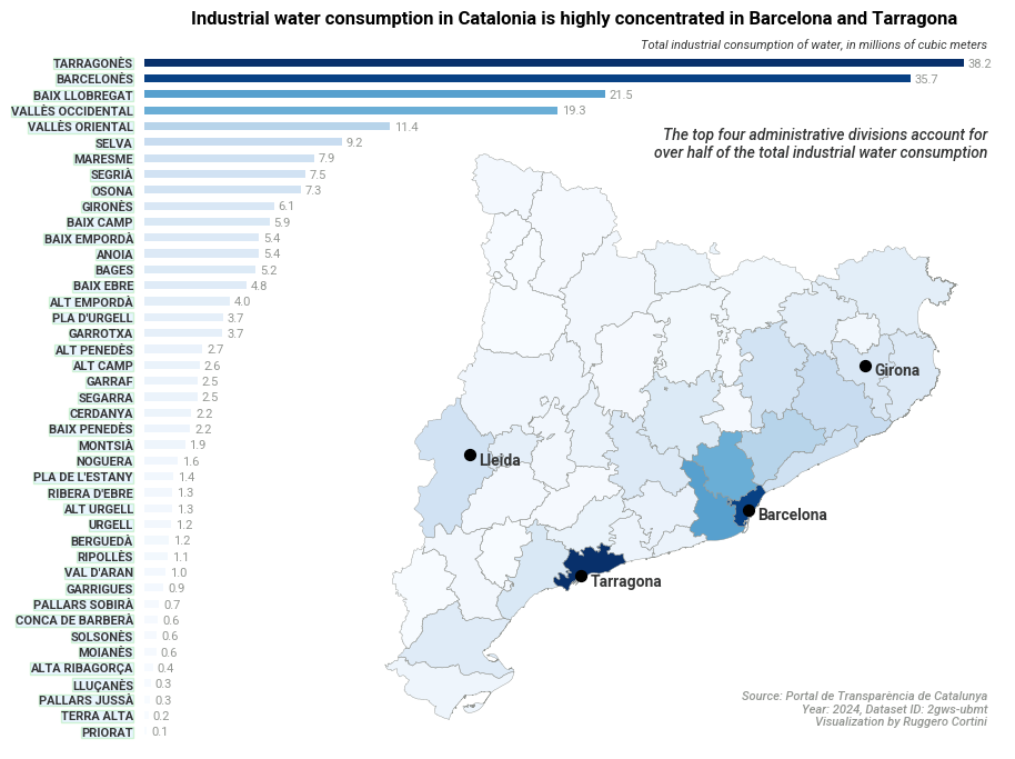
The concentration is stark: the top four comarques account for over half of total industrial water consumption. Barcelonès and its neighbours dominate, with a secondary cluster around Tarragona driven by the petrochemical complex at the mouth of the Ebre.
Analysis
The notebook below walks through the full pipeline: fetching consumption data from the Socrata API, loading comarca boundaries from a GeoJSON zip, merging the two datasets, and producing the visualisation. Download here.